
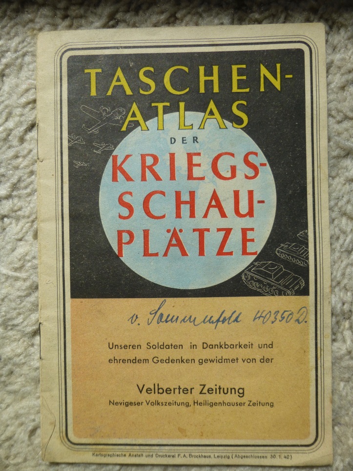
This tiny atlas shows the state of the world during World War II in January of 1942. It was distributed by the Velberter Zeitung, Nevigeser Zeitung, and Heiligenhauser Zeitung (newspapers). I’m guessing it just came as an insert to a special edition of the paper. Each page or double-page is a color map showing a different portion of the world. This is basically a propaganda piece. The cartographers didn’t hesitate to claim any occupied territory as part of Germany, and made former colonies look as if they still belonged to Germany. Each map has statistics to accompany it, showing the area and population of each nation.
The first map is an overview map of the world. It’s a wonderful example of cartographic propaganda. It shows the lands controlled by the world’s largest colonizers, and a neutral color for countries not under a colonizer’s possession. Using the mercator projection, Alaska, Canada, Greenland, and the Soviet Union are greatly exaggerated. Germany’s colonies are conveniently all within the tropics, far from the poles, where size exaggeration is greatest. With Alaska, Canada, Greenland, and Soviet Union so greatly exaggerated, the relative size of Germany’s colonies is downplayed, as if to say “Look, we don’t have as much land as any of these powers!” Another interesting thing to note: all of Germany’s colonies shown on the map were actually given up in the Treaty of Versailles at the end of World War I nearly a quarter of a century prior to the publish of this map. In the following maps there is mention of the former colonies, but in this map, there’s no way to tell. The former colonies are simply part of the “Deutsches Reich”.

The next maps are the Atlantic and Pacific areas. Germany has a presence in both areas—at least according to them. The colonies that were surrendered 20+ years prior, are shown in the same color as Germany, though nominally this map acknowledges that they’re a “former German colonial possession” (Alter deutscher Kolonialbesitz). In the Atlantic area, a portion of the German Empire is shown, as well as Cameroon (shown as it’s largest colonial extent, rather than the borders of the time) and Togo. It actually only shows the northern part of the Atlantic. I suppose that might be due to a colonist’s mindset; “no need to show any more of South America since there are no colonies”. Had they showed a bit more of Africa, they would have shown Deutsch Südwest Afrika (German Southwest Africa) now known as Namibia. Interestingly, at the very edge of the map they show Portuguese West Africa, which they called Angola in the previous map. Perhaps they were unsure of which name to use.

In the Pacific area map, there are a few curious representations. Manchuria (Mandschukuo) is depicted as an independent country, but to me, the color looks awfully close to the color used for Japan within the thick brown border. It may be a subtle way of showing the relation between Manchuria and Japan (Manchuria being a puppet state of the Japanese Empire). What isn’t shown however are the areas of China occupied by Japan. Being German allies, I would have thought that they might try to exaggerate Japan’s land claims. I guess not.
Tannu-Tuwa near Mongolia (Also known as the People’s Republic of Tuva) was a republic recognized officially only by Mongolia and the Soviet Union according to Wikipedia. It’s interesting then that this German map shows Tannu-Tuwa as an independent state.
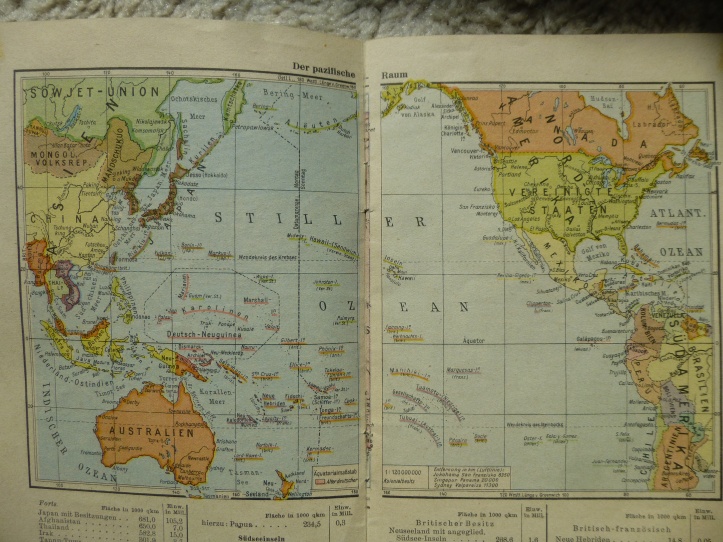
In the Southeast Asia map, one can see a bit easier that Hainan and Formosa are both shown as Japanese, which I thought might be showing recent additions to the Japanese Empire, but nope. Taiwan (Formosa) and Hainan had both been under Japanese control for some time (since 1895 and 1939 respectively [though admittedly, 1939 is pretty recent for this map]). There’s still no mention however of the Japanese-occupied areas of China on the coast.
The Japanese had actually invaded Kaiser Wilhelmsland (Here shown as German) in December 1941 along with the operations to bomb Hawai’i, and invade Guam, the Philippines, etc. I wonder if there was a decision not to show the result of these invasions, or if they had happened recently enough that there wasn’t time to change the maps to show it.

The map of Europe shows a quite large German Empire, with certain areas shown as subsections of the German Empire (The General Government in Poland, and Northern Slovenia). Though Luxembourg is shown as part of the German Empire, there nevertheless seems to be a border shown. I’m not sure what that is trying to convey.
Yugoslavia is split, but not how I’ve usually seen (like in this map). It seems like the parts annexed by non-German nations are all shown together as Serbia (Serbien).

The East Africa map shows Northeast Africa as well as a portion of the Arabian Peninsula and the Middle east. Though on the very edge of the map, one can make out the northern edge of what is now Tanzania. It’s colored like the rest of the German Empire has been (or in this case former German colonies). The thing is: Tanzania was a British colony at the time, so it logically should have had the same color as the rest of the British colonies on the map English-Egyptian Sudan, Uganda, Kenya, etc.)

In the North Africa map, you can better see Cameroon (Kamerun) shown overspilling its then-current boundaries. It’s showing the largest extent of the German colonies borders during World War I, exaggerating their presence in the area (or at least giving the appearance that there’s a presence at all).

The final map is a map of the Mediterranean area. Romania (Rumänien) is shown with its rather temporary 1941 borders after the loss of Bessarabia to the Soviet Union and Northern Transylvania to Hungary (Ungarn) after a Soviet ultimatum and an axis-mediated compromise between Romania and Hungary. (Both happening in the summer of 1940)

It’s amusing to me that this atlas seems to both exaggerate and downplay German power. Exaggeration in the form of showing all former colonies as still part of the empire, and downplaying in the form of using a Mercator projection to show little ‘ole Germany with it’s few small tropical colonies compared to the giants of America (Alaska) Britain (Canada), Denmark (Greenland/Iceland), and the Soviet Union.

[…] go along with my last post [Taschenatlas der Kriegsschauplätze (Pocket Atlas of War Locales)], this map is also a German map from World War II. This map shows the Eastern Front of the […]
LikeLike